
- Start >
- Groundwater >
- Waterlevel of deep layer >
- Obere Donau >
- FROTZHOFEN T5 >
- Current data

Current data FROTZHOFEN T5
Groundwater levels of the last 12 months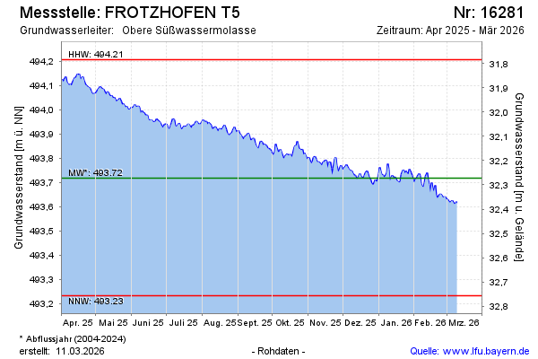
Groundwater level [m above sealevel]: 493.51
Distance to surface [m]: 32.48
Last value from 03.05.2026 09:00
Ground level [m above sealevel]: 525.99
| Date | Groundwater level [m above sealevel] |
|---|---|
| 03.05.2026 | 493.51 |
| 02.05.2026 | 493.50 |
| 01.05.2026 | 493.49 |
| 30.04.2026 | 493.49 |
| 29.04.2026 | 493.51 |
| 28.04.2026 | 493.53 |
| 27.04.2026 | 493.52 |
| 26.04.2026 | 493.52 |
© Bayerisches Landesamt für Umwelt 2026