
- Start >
- Groundwater >
- Waterlevel of deep layer >
- Obere Donau >
- FISCHERHÄUSER T2A >
- Current data

Current data FISCHERHÄUSER T2A
Groundwater levels of the last 12 months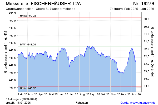
Groundwater level [m above sealevel]: 446.46
Distance to surface [m]: 33.64
Last value from 10.05.2026 10:00
Ground level [m above sealevel]: 480.10
| Date | Groundwater level [m above sealevel] |
|---|---|
| 10.05.2026 | 446.68 |
| 09.05.2026 | 446.61 |
| 08.05.2026 | 446.56 |
| 07.05.2026 | 446.51 |
| 06.05.2026 | 446.50 |
| 05.05.2026 | 446.50 |
| 04.05.2026 | 446.50 |
| 03.05.2026 | 446.55 |
© Bayerisches Landesamt für Umwelt 2026