
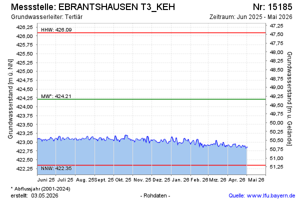
Current data Ebrantshausen T3
Groundwater level [m above sealevel]: 422.79
Distance to surface [m]: 50.76
Last value from 13.07.2026 10:00
Ground level [m above sealevel]: 473.55
| Date | Groundwater level [m above sealevel] |
|---|---|
| 13.07.2026 | 422.78 |
| 12.07.2026 | 422.77 |
| 11.07.2026 | 422.80 |
| 10.07.2026 | 422.82 |
| 09.07.2026 | 422.82 |
| 08.07.2026 | 422.83 |
| 07.07.2026 | 422.85 |
| 06.07.2026 | 422.82 |