
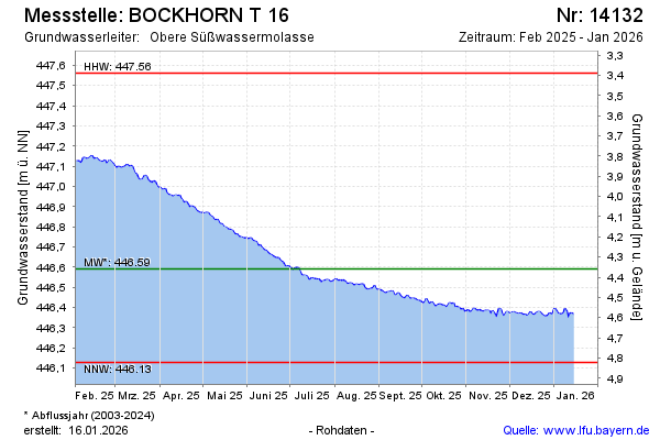
Current data BOCKHORN T 16
Groundwater level [m above sealevel]: 446.25
Distance to surface [m]: 4.7
Last value from 13.07.2026 09:00
Ground level [m above sealevel]: 450.95
| Date | Groundwater level [m above sealevel] |
|---|---|
| 13.07.2026 | 446.26 |
| 12.07.2026 | 446.26 |
| 11.07.2026 | 446.27 |
| 10.07.2026 | 446.28 |
| 09.07.2026 | 446.28 |
| 08.07.2026 | 446.28 |
| 07.07.2026 | 446.29 |
| 06.07.2026 | 446.29 |