
- Start >
- Groundwater >
- Waterlevel of deep layer >
- Obere Donau >
- BAUMBERG T 10 >
- Chart of total period

Chart of total period BAUMBERG T 10
Groundwater levels of the total period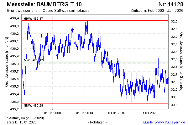
Groundwater level [m above sealevel]: 435.51
Distance to surface [m]: 32.85
Last value from 22.05.2026 10:00
Ground level [m above sealevel]: 468.36
| Date | Groundwater level [m above sealevel] |
|---|---|
| 22.05.2026 | 435.51 |
| 21.05.2026 | 435.51 |
| 20.05.2026 | 435.52 |
| 19.05.2026 | 435.54 |
| 18.05.2026 | 435.56 |
| 17.05.2026 | 435.56 |
| 16.05.2026 | 435.59 |
| 15.05.2026 | 435.53 |
© Bayerisches Landesamt für Umwelt 2026