
- Start >
- Groundwater >
- Waterlevel of deep layer >
- Obere Donau >
- Ammerfeld, B1 >
- Current data

Current data Ammerfeld, B1
Groundwater levels of the last 12 months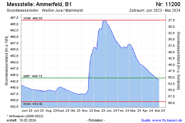
Groundwater level [m above sealevel]: 444.46
Distance to surface [m]: 49.54
Last value from 02.05.2024 06:00
Ground level [m above sealevel]: 494.00
| Date | Groundwater level [m above sealevel] |
|---|---|
| 01.05.2024 | 444.54 |
| 30.04.2024 | 444.65 |
| 29.04.2024 | 444.78 |
| 28.04.2024 | 444.94 |
| 27.04.2024 | 445.11 |
| 26.04.2024 | 445.28 |
| 25.04.2024 | 445.44 |
| 24.04.2024 | 445.59 |
© Bayerisches Landesamt für Umwelt 2024