
- Start >
- Groundwater >
- Waterlevel of deep layer >
- Obere Donau >
- Achering T 9t >
- Chart of total period

Chart of total period Achering T 9t
Groundwater levels of the total period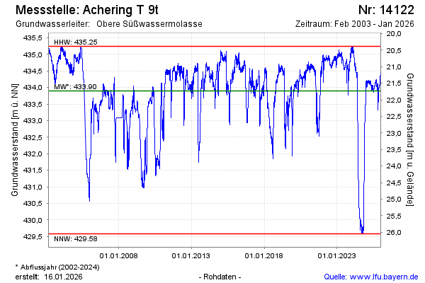
Groundwater level [m above sealevel]: 434.39
Distance to surface [m]: 21.24
Last value from 06.05.2024 09:00
Ground level [m above sealevel]: 455.63
| Date | Groundwater level [m above sealevel] |
|---|---|
| 06.05.2024 | 434.41 |
| 05.05.2024 | 434.46 |
| 04.05.2024 | 434.46 |
| 03.05.2024 | 434.46 |
| 02.05.2024 | 434.50 |
| 01.05.2024 | 434.51 |
| 30.04.2024 | 434.51 |
| 29.04.2024 | 434.51 |
© Bayerisches Landesamt für Umwelt 2024