
- Start >
- Groundwater >
- Waterlevel of deep layer >
- Isar >
- Unterholzhausen T15 >
- Current data

Current data Unterholzhausen T15
Groundwater levels of the last 12 months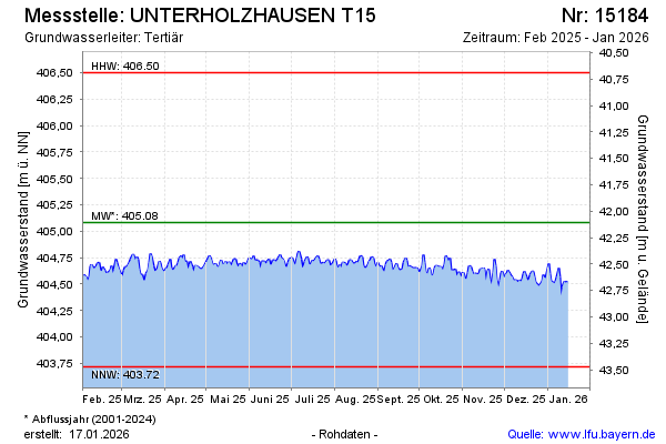
Groundwater level [m above sealevel]: 404.45
Distance to surface [m]: 42.74
Last value from 08.03.2026 10:00
Ground level [m above sealevel]: 447.19
| Date | Groundwater level [m above sealevel] |
|---|---|
| 08.03.2026 | 404.46 |
| 07.03.2026 | 404.46 |
| 06.03.2026 | 404.49 |
| 05.03.2026 | 404.48 |
| 04.03.2026 | 404.44 |
| 03.03.2026 | 404.45 |
| 02.03.2026 | 404.46 |
| 01.03.2026 | 404.44 |
© Bayerisches Landesamt für Umwelt 2026