
- Start >
- Groundwater >
- Waterlevel of deep layer >
- Isar >
- ROTTBACH T 11 >
- Chart of total period

Chart of total period ROTTBACH T 11
Groundwater levels of the total period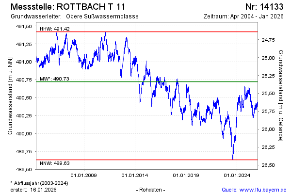
Groundwater level [m above sealevel]: 490.40
Distance to surface [m]: 25.66
Last value from 28.04.2024 09:00
Ground level [m above sealevel]: 516.06
| Date | Groundwater level [m above sealevel] |
|---|---|
| 28.04.2024 | 490.40 |
| 27.04.2024 | 490.41 |
| 26.04.2024 | 490.42 |
| 25.04.2024 | 490.43 |
| 24.04.2024 | 490.43 |
| 23.04.2024 | 490.42 |
| 22.04.2024 | 490.41 |
| 21.04.2024 | 490.41 |
© Bayerisches Landesamt für Umwelt 2024