
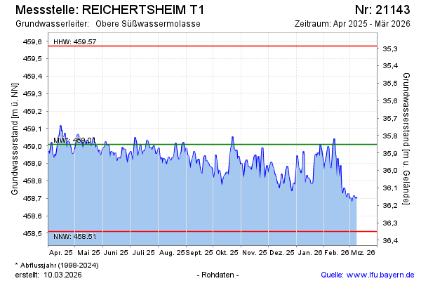
Current data REICHERTSHEIM T1
Groundwater level [m above sealevel]: 458.65
Distance to surface [m]: 36.21
Last value from 11.07.2026 10:00
Ground level [m above sealevel]: 494.86
| Date | Groundwater level [m above sealevel] |
|---|---|
| 11.07.2026 | 458.66 |
| 10.07.2026 | 458.67 |
| 09.07.2026 | 458.66 |
| 08.07.2026 | 458.67 |
| 07.07.2026 | 458.67 |
| 06.07.2026 | 458.64 |
| 05.07.2026 | 458.63 |
| 04.07.2026 | 458.61 |