
Chart of total period Obermenzing T 3 T
Groundwater level [m above sealevel]: 482.13
Distance to surface [m]: 33.74
Last value from 13.07.2026 10:00
Ground level [m above sealevel]: 515.87
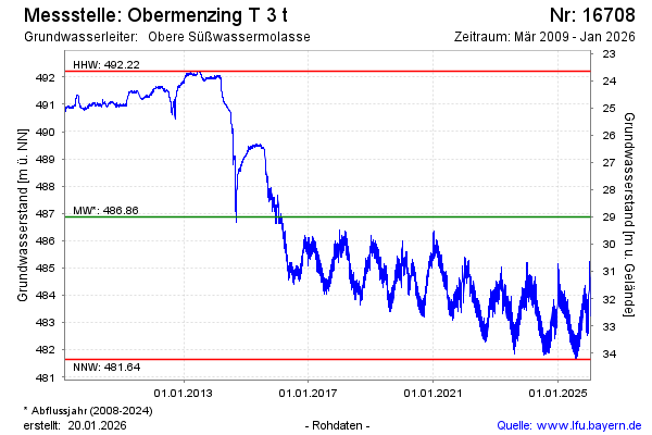
| Date | Groundwater level [m above sealevel] |
|---|---|
| 13.07.2026 | 482.15 |
| 12.07.2026 | 481.92 |
| 11.07.2026 | 481.45 |
| 10.07.2026 | 481.39 |
| 09.07.2026 | 481.59 |
| 08.07.2026 | 481.72 |
| 07.07.2026 | 481.91 |
| 06.07.2026 | 482.16 |