
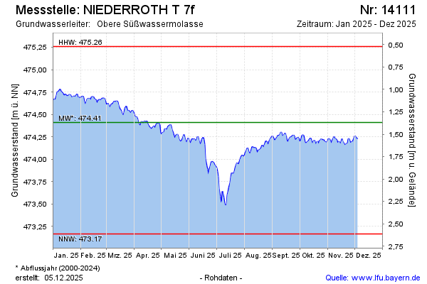
Current data NIEDERROTH T 7f
Groundwater level [m above sealevel]: 473.23
Distance to surface [m]: 2.55
Last value from 13.07.2026 09:00
Ground level [m above sealevel]: 475.78
| Date | Groundwater level [m above sealevel] |
|---|---|
| 13.07.2026 | 473.26 |
| 12.07.2026 | 473.37 |
| 11.07.2026 | 473.52 |
| 10.07.2026 | 473.65 |
| 09.07.2026 | 473.65 |
| 08.07.2026 | 473.66 |
| 07.07.2026 | 473.64 |
| 06.07.2026 | 473.60 |