
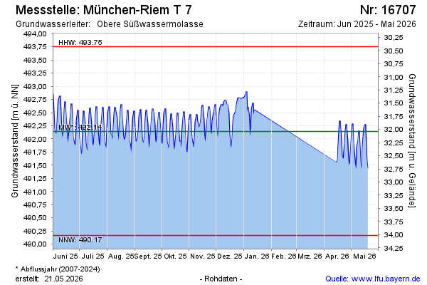
Current data München-Riem T 7
note
Aufgrund eines Defektes am Messgerät gibt es im Zeitraum Januar - April 2026 eine Datenlücke.
Groundwater level [m above sealevel]: 491.60
Distance to surface [m]: 32.58
Last value from 13.07.2026 10:00
Ground level [m above sealevel]: 524.18
| Date | Groundwater level [m above sealevel] |
|---|---|
| 13.07.2026 | 491.72 |
| 12.07.2026 | 491.85 |
| 11.07.2026 | 491.66 |
| 10.07.2026 | 491.21 |
| 09.07.2026 | 491.12 |
| 08.07.2026 | 491.12 |
| 07.07.2026 | 491.27 |
| 06.07.2026 | 491.62 |