
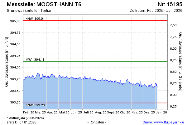
Current data MOOSTHANN T6
Groundwater level [m above sealevel]: 393.44
Distance to surface [m]: 8.97
Last value from 01.07.2026 10:00
Ground level [m above sealevel]: 402.41
| Date | Groundwater level [m above sealevel] |
|---|---|
| 28.06.2026 | 393.44 |
| 27.06.2026 | 393.44 |
| 26.06.2026 | 393.44 |
| 25.06.2026 | 393.44 |
| 24.06.2026 | 393.45 |
| 23.06.2026 | 393.44 |
| 22.06.2026 | 393.43 |
| 21.06.2026 | 393.42 |