
Chart of total period GILCHING 808
Groundwater level [m above sealevel]: 511.92
Distance to surface [m]: 35.21
Last value from 13.07.2026 19:00
Ground level [m above sealevel]: 547.13
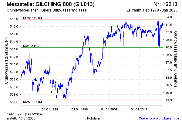
| Date | Groundwater level [m above sealevel] |
|---|---|
| 13.07.2026 | 511.91 |
| 12.07.2026 | 511.92 |
| 11.07.2026 | 511.95 |
| 10.07.2026 | 511.97 |
| 09.07.2026 | 511.98 |
| 08.07.2026 | 511.99 |
| 07.07.2026 | 512.01 |
| 06.07.2026 | 512.01 |