
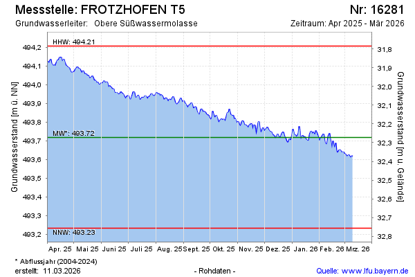
Current data FROTZHOFEN T5
Groundwater level [m above sealevel]: 493.35
Distance to surface [m]: 32.64
Last value from 02.07.2026 09:00
Ground level [m above sealevel]: 525.99
| Date | Groundwater level [m above sealevel] |
|---|---|
| 02.07.2026 | 493.35 |
| 01.07.2026 | 493.35 |
| 30.06.2026 | 493.33 |
| 29.06.2026 | 493.33 |
| 28.06.2026 | 493.34 |
| 27.06.2026 | 493.35 |
| 26.06.2026 | 493.35 |
| 25.06.2026 | 493.36 |