
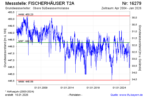
Chart of total period FISCHERHÄUSER T2A
Groundwater level [m above sealevel]: 446,32
Distance to surface [m]: 33,78
Last value from 22.07.2026 10:00
Ground level [m above sealevel]: 480.10
| Date | Groundwater level [m above sealevel] |
|---|---|
| 22.07.2026 | 446.56 |
| 21.07.2026 | 446.58 |
| 20.07.2026 | 446.58 |
| 19.07.2026 | 446.59 |
| 18.07.2026 | 446.48 |
| 17.07.2026 | 446.39 |
| 16.07.2026 | 446.29 |
| 15.07.2026 | 446.27 |