
Current data Eschenried T 17t
Groundwater level [m above sealevel]: 485.46
Distance to surface [m]: 9.45
Last value from 13.07.2026 10:00
Ground level [m above sealevel]: 494.91
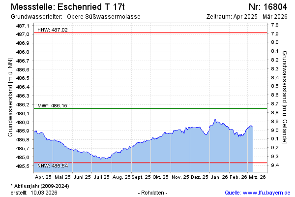
| Date | Groundwater level [m above sealevel] |
|---|---|
| 12.07.2026 | 485.48 |
| 11.07.2026 | 485.48 |
| 10.07.2026 | 485.49 |
| 09.07.2026 | 485.50 |
| 08.07.2026 | 485.50 |
| 07.07.2026 | 485.50 |
| 06.07.2026 | 485.50 |
| 05.07.2026 | 485.50 |