
- Start >
- Groundwater >
- Waterlevel of deep layer >
- Isar >
- Ebrantshausen T3 >
- Chart of total period

Chart of total period Ebrantshausen T3
Groundwater levels of the total period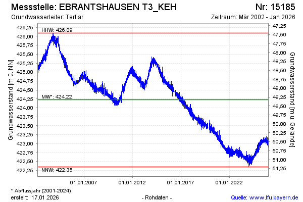
Groundwater level [m above sealevel]: 422.49
Distance to surface [m]: 51.06
Last value from 04.05.2024 10:00
Ground level [m above sealevel]: 473.55
| Date | Groundwater level [m above sealevel] |
|---|---|
| 04.05.2024 | 422.49 |
| 03.05.2024 | 422.52 |
| 02.05.2024 | 422.64 |
| 01.05.2024 | 422.61 |
| 30.04.2024 | 422.53 |
| 29.04.2024 | 422.48 |
| 28.04.2024 | 422.52 |
| 27.04.2024 | 422.55 |
© Bayerisches Landesamt für Umwelt 2024