
- Start >
- Groundwater >
- Waterlevel of deep layer >
- Isar >
- BRUNNEN I Furth >
- Chart of total period

Chart of total period BRUNNEN I Furth
Groundwater levels of the total period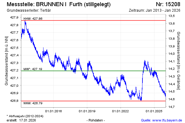
Groundwater level [m above sealevel]: 426.87
Distance to surface [m]: 14.55
Last value from 21.01.2026 10:00
Ground level [m above sealevel]: 441.42
| Date | Groundwater level [m above sealevel] |
|---|---|
| 20.01.2026 | 426.85 |
| 19.01.2026 | 426.85 |
| 18.01.2026 | 426.85 |
| 17.01.2026 | 426.85 |
| 16.01.2026 | 426.85 |
| 15.01.2026 | 426.86 |
| 14.01.2026 | 426.86 |
| 13.01.2026 | 426.86 |
© Bayerisches Landesamt für Umwelt 2026