
- Start >
- Groundwater >
- Waterlevel of deep layer >
- Isar >
- BERGHEIM B4 >
- Chart of total period

Chart of total period BERGHEIM B4
Groundwater levels of the total period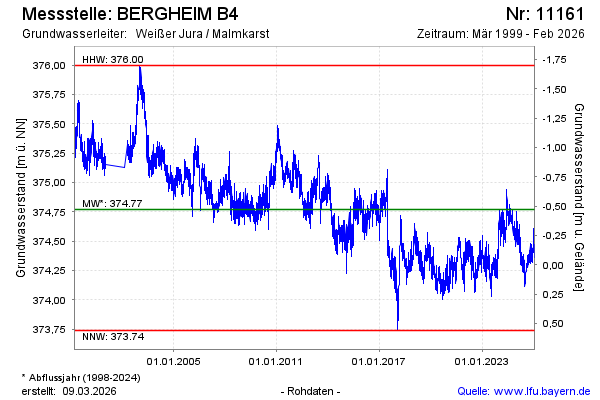
Groundwater level [m above sealevel]: 374.79
Distance to surface [m]: -0.49
Last value from 05.06.2024 10:00
Ground level [m above sealevel]: 374.30
| Date | Groundwater level [m above sealevel] |
|---|---|
| 05.06.2024 | 374.84 |
| 04.06.2024 | 374.84 |
| 03.06.2024 | 374.80 |
| 02.06.2024 | 374.74 |
| 01.06.2024 | 374.74 |
| 31.05.2024 | 374.66 |
| 30.05.2024 | 374.66 |
| 29.05.2024 | 374.61 |
© Bayerisches Landesamt für Umwelt 2024