
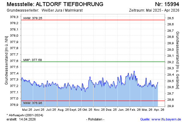
Current data ALTDORF TIEFBOHRUNG
note
Keine Beobachtung von 04/2010 bis 09/2021
Groundwater level [m above sealevel]: 377,02
Distance to surface [m]: 29,76
Last value from 22.07.2026 10:00
Ground level [m above sealevel]: 406.78
| Date | Groundwater level [m above sealevel] |
|---|---|
| 22.07.2026 | 377.02 |
| 21.07.2026 | 377.03 |
| 20.07.2026 | 377.04 |
| 19.07.2026 | 377.07 |
| 18.07.2026 | 377.08 |
| 17.07.2026 | 377.08 |
| 16.07.2026 | 377.06 |
| 15.07.2026 | 377.06 |