
- Start >
- Groundwater >
- Waterlevel of deep layer >
- Inn >
- Unterholzhausen T15 >
- Chart of total period

Chart of total period Unterholzhausen T15
Groundwater levels of the total period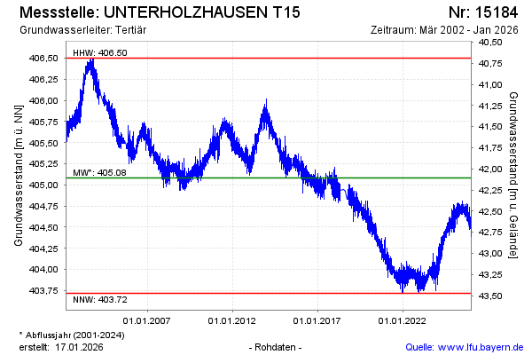
Groundwater level [m above sealevel]: 404.39
Distance to surface [m]: 42.80
Last value from 21.05.2024 10:00
Ground level [m above sealevel]: 447.19
| Date | Groundwater level [m above sealevel] |
|---|---|
| 21.05.2024 | 404.38 |
| 20.05.2024 | 404.34 |
| 19.05.2024 | 404.32 |
| 18.05.2024 | 404.31 |
| 17.05.2024 | 404.35 |
| 16.05.2024 | 404.39 |
| 15.05.2024 | 404.40 |
| 14.05.2024 | 404.40 |
© Bayerisches Landesamt für Umwelt 2024