
- Start >
- Groundwater >
- Waterlevel of deep layer >
- Inn >
- REISBACH 968 >
- Current data

Current data REISBACH 968
Groundwater levels of the last 12 months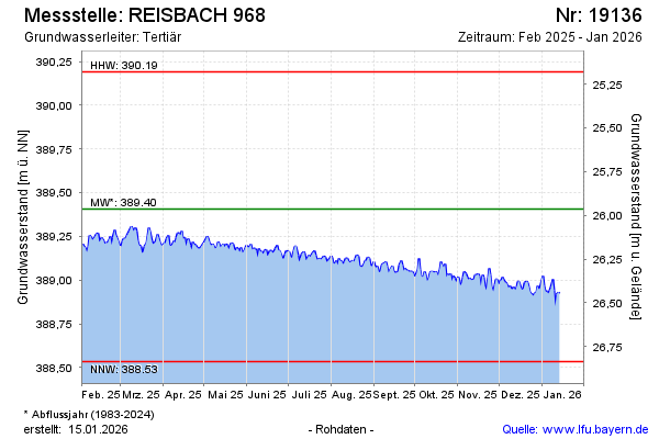
Groundwater level [m above sealevel]: 388.93
Distance to surface [m]: 26.44
Last value from 03.05.2026 10:00
Ground level [m above sealevel]: 415.37
| Date | Groundwater level [m above sealevel] |
|---|---|
| 03.05.2026 | 388.93 |
| 02.05.2026 | 388.91 |
| 01.05.2026 | 388.87 |
| 30.04.2026 | 388.85 |
| 29.04.2026 | 388.88 |
| 28.04.2026 | 388.91 |
| 27.04.2026 | 388.89 |
| 26.04.2026 | 388.88 |
© Bayerisches Landesamt für Umwelt 2026