
- Start >
- Groundwater >
- Waterlevel of deep layer >
- Inn >
- OBERRONING T2 >
- Chart of total period

Chart of total period OBERRONING T2
Groundwater levels of the total period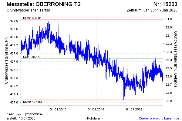
Groundwater level [m above sealevel]: 407.35
Distance to surface [m]: 22.57
Last value from 27.04.2024 10:00
Ground level [m above sealevel]: 429.92
| Date | Groundwater level [m above sealevel] |
|---|---|
| 27.04.2024 | 407.36 |
| 26.04.2024 | 407.37 |
| 25.04.2024 | 407.36 |
| 24.04.2024 | 407.35 |
| 23.04.2024 | 407.31 |
| 22.04.2024 | 407.29 |
| 21.04.2024 | 407.31 |
| 20.04.2024 | 407.33 |
© Bayerisches Landesamt für Umwelt 2024