
- Start >
- Groundwater >
- Waterlevel of deep layer >
- Inn >
- Hochmutting T 1f >
- Current data

Current data Hochmutting T 1f
Groundwater levels of the last 12 months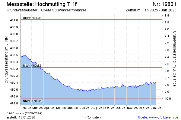
Groundwater level [m above sealevel]: 480.49
Distance to surface [m]: 9.40
Last value from 02.05.2024 10:00
Ground level [m above sealevel]: 489.89
| Date | Groundwater level [m above sealevel] |
|---|---|
| 02.05.2024 | 480.49 |
| 01.05.2024 | 480.48 |
| 30.04.2024 | 480.48 |
| 29.04.2024 | 480.47 |
| 28.04.2024 | 480.49 |
| 27.04.2024 | 480.51 |
| 26.04.2024 | 480.52 |
| 25.04.2024 | 480.52 |
© Bayerisches Landesamt für Umwelt 2024