
- Start >
- Groundwater >
- Waterlevel of deep layer >
- Inn >
- FROTZHOFEN T5 >
- Chart of total period

Chart of total period FROTZHOFEN T5
Groundwater levels of the total period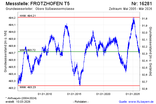
Groundwater level [m above sealevel]: 493.81
Distance to surface [m]: 32.18
Last value from 03.05.2024 09:00
Ground level [m above sealevel]: 525.99
| Date | Groundwater level [m above sealevel] |
|---|---|
| 03.05.2024 | 493.82 |
| 02.05.2024 | 493.85 |
| 01.05.2024 | 493.84 |
| 30.04.2024 | 493.81 |
| 29.04.2024 | 493.80 |
| 28.04.2024 | 493.82 |
| 27.04.2024 | 493.84 |
| 26.04.2024 | 493.85 |
© Bayerisches Landesamt für Umwelt 2024