
- Start >
- Groundwater >
- Waterlevel of deep layer >
- Iller - Lech - Bodensee >
- Tiefenried GS1 >
- Current data

Current data Tiefenried GS1
Groundwater levels of the last 12 months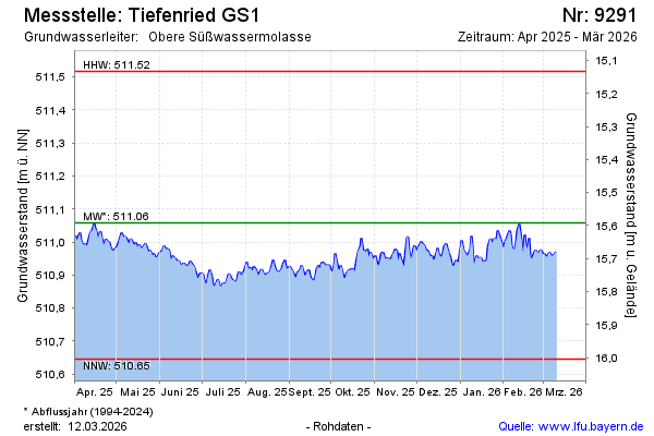
note
Störung der Messeinrichtung: Messwerte ab Sept. 2022 unsicher!
Groundwater level [m above sealevel]: 510.94
Distance to surface [m]: 15.71
Last value from 05.05.2026 09:56
Ground level [m above sealevel]: 526.65
| Date | Groundwater level [m above sealevel] |
|---|---|
| 05.05.2026 | 510.92 |
| 04.05.2026 | 510.92 |
| 03.05.2026 | 510.92 |
| 02.05.2026 | 510.90 |
| 01.05.2026 | 510.89 |
| 30.04.2026 | 510.89 |
| 29.04.2026 | 510.91 |
| 28.04.2026 | 510.93 |
© Bayerisches Landesamt für Umwelt 2026