
- Start >
- Groundwater >
- Waterlevel of deep layer >
- Iller - Lech - Bodensee >
- THANNHAUSEN A,FB 889 >
- Current data

Current data THANNHAUSEN A,FB 889
Groundwater levels of the last 12 months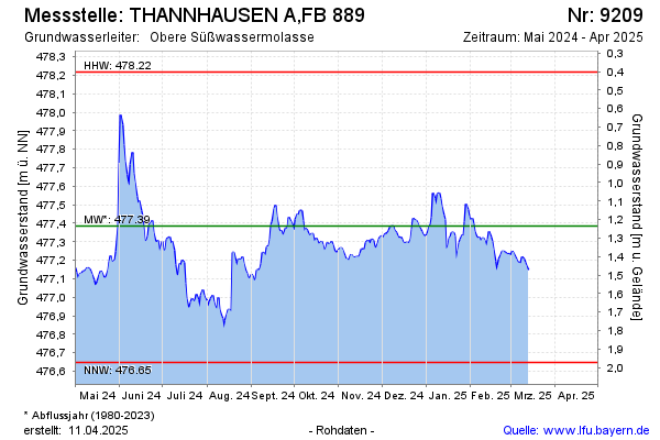
Groundwater level [m above sealevel]: 476.93
Distance to surface [m]: 1.69
Last value from 03.05.2026 07:00
Ground level [m above sealevel]: 478.62
| Date | Groundwater level [m above sealevel] |
|---|---|
| 03.05.2026 | 476.98 |
| 02.05.2026 | 476.98 |
| 01.05.2026 | 476.95 |
| 30.04.2026 | 476.94 |
| 29.04.2026 | 476.97 |
| 28.04.2026 | 476.98 |
| 27.04.2026 | 476.99 |
| 26.04.2026 | 476.98 |
© Bayerisches Landesamt für Umwelt 2026