
- Start >
- Groundwater >
- Waterlevel of deep layer >
- Iller - Lech - Bodensee >
- Gempfing W4 >
- Chart of total period

Chart of total period Gempfing W4
Groundwater levels of the total period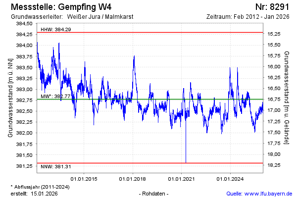
Groundwater level [m above sealevel]: 382.19
Distance to surface [m]: 17.33
Last value from 03.05.2026 09:00
Ground level [m above sealevel]: 399.52
| Date | Groundwater level [m above sealevel] |
|---|---|
| 03.05.2026 | 382.20 |
| 02.05.2026 | 382.24 |
| 01.05.2026 | 382.24 |
| 30.04.2026 | 382.28 |
| 29.04.2026 | 382.29 |
| 28.04.2026 | 382.33 |
| 27.04.2026 | 382.25 |
| 26.04.2026 | 382.23 |
© Bayerisches Landesamt für Umwelt 2026