
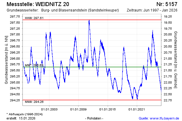
Chart of total period WEIDNITZ 20
note
Datenübertragung gestört
Groundwater level [m above sealevel]: 294.42
Distance to surface [m]: 22.58
Last value from 17.06.2026 07:00
Ground level [m above sealevel]: 317.00
| Date | Groundwater level [m above sealevel] |
|---|---|
| 17.06.2026 | 294.43 |
| 16.06.2026 | 294.44 |
| 15.06.2026 | 294.44 |
| 14.06.2026 | 294.45 |
| 13.06.2026 | 294.45 |
| 12.06.2026 | 294.45 |
| 11.06.2026 | 294.44 |
| 10.06.2026 | 294.45 |