
Current data RAMLESREUTH D 999
Groundwater level [m above sealevel]: 456.24
Distance to surface [m]: 3.97
Last value from 15.07.2026 04:00
Ground level [m above sealevel]: 460.21
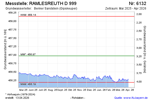
| Date | Groundwater level [m above sealevel] |
|---|---|
| 14.07.2026 | 456.23 |
| 13.07.2026 | 456.22 |
| 12.07.2026 | 456.22 |
| 11.07.2026 | 456.23 |
| 10.07.2026 | 456.24 |
| 09.07.2026 | 456.24 |
| 08.07.2026 | 456.25 |
| 07.07.2026 | 456.25 |