
- Start >
- Groundwater >
- Waterlevel of deep layer >
- Oberer Main - Elbe >
- Kirchlauter KMS3 >
- Chart of total period

Chart of total period Kirchlauter KMS3
Groundwater levels of the total period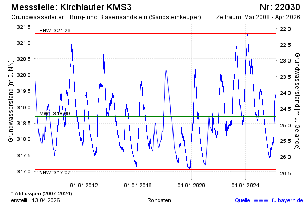
Groundwater level [m above sealevel]: 318.49
Distance to surface [m]: 24.95
Last value from 21.05.2026 10:00
Ground level [m above sealevel]: 343.44
| Date | Groundwater level [m above sealevel] |
|---|---|
| 21.05.2026 | 318.51 |
| 20.05.2026 | 318.53 |
| 19.05.2026 | 318.54 |
| 18.05.2026 | 318.56 |
| 17.05.2026 | 318.58 |
| 16.05.2026 | 318.62 |
| 15.05.2026 | 318.65 |
| 14.05.2026 | 318.66 |
© Bayerisches Landesamt für Umwelt 2026