
- Start >
- Groundwater >
- Waterlevel of deep layer >
- Bayern >
- Zusmarshausen T7 >
- Chart of total period

Chart of total period Zusmarshausen T7
Groundwater levels of the total period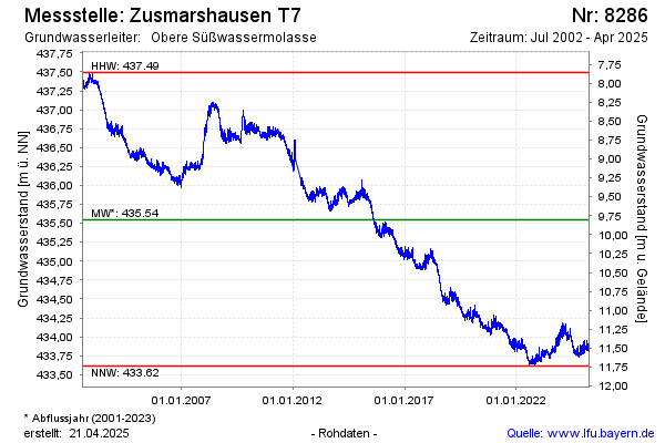
Groundwater level [m above sealevel]: 433.52
Distance to surface [m]: 11.83
Last value from 14.04.2026 08:00
Ground level [m above sealevel]: 445.35
| Date | Groundwater level [m above sealevel] |
|---|---|
| 14.04.2026 | 433.54 |
| 13.04.2026 | 433.56 |
| 12.04.2026 | 433.54 |
| 11.04.2026 | 433.54 |
| 10.04.2026 | 433.53 |
| 09.04.2026 | 433.51 |
| 08.04.2026 | 433.49 |
| 07.04.2026 | 433.50 |
© Bayerisches Landesamt für Umwelt 2026