
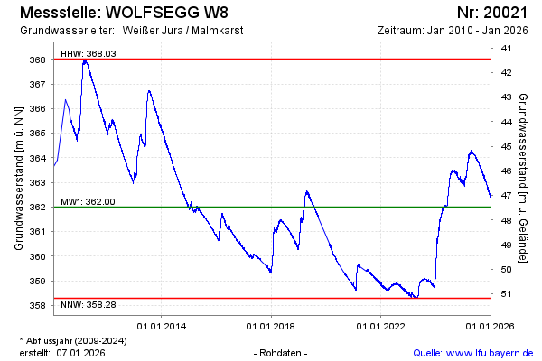
Chart of total period WOLFSEGG W8
note
Absenkung der Ganglinie durch Neuvermessung der Höhenlage im November 2022 verursacht.
Groundwater level [m above sealevel]: 361,07
Distance to surface [m]: 48,40
Last value from 22.07.2026 10:00
Ground level [m above sealevel]: 409.47
| Date | Groundwater level [m above sealevel] |
|---|---|
| 22.07.2026 | 361.06 |
| 21.07.2026 | 361.06 |
| 20.07.2026 | 361.07 |
| 19.07.2026 | 361.08 |
| 18.07.2026 | 361.11 |
| 17.07.2026 | 361.13 |
| 16.07.2026 | 361.11 |
| 15.07.2026 | 361.12 |