
Chart of total period Willmars BO A
Groundwater level [m above sealevel]: 312,88
Distance to surface [m]: 13,05
Last value from 22.07.2026 10:00
Ground level [m above sealevel]: 325.93
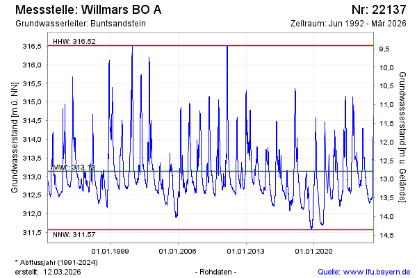
| Date | Groundwater level [m above sealevel] |
|---|---|
| 22.07.2026 | 312.89 |
| 21.07.2026 | 312.89 |
| 20.07.2026 | 312.90 |
| 19.07.2026 | 312.90 |
| 18.07.2026 | 312.91 |
| 17.07.2026 | 312.89 |
| 16.07.2026 | 312.89 |
| 15.07.2026 | 312.90 |