
- Start >
- Groundwater >
- Waterlevel of deep layer >
- Bayern >
- Westheim Brunnen II >
- Current data

Current data Westheim Brunnen II
Groundwater levels of the last 12 months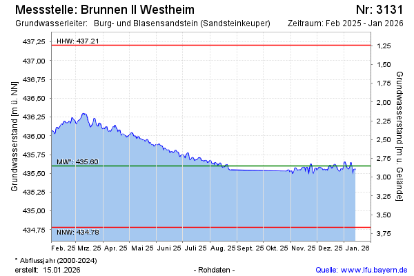
Groundwater level [m above sealevel]: 435.92
Distance to surface [m]: 2.53
Last value from 09.03.2026 13:00
Ground level [m above sealevel]: 438.45
| Date | Groundwater level [m above sealevel] |
|---|---|
| 09.03.2026 | 435.92 |
| 08.03.2026 | 435.90 |
| 07.03.2026 | 435.90 |
| 06.03.2026 | 435.91 |
| 05.03.2026 | 435.90 |
| 04.03.2026 | 435.87 |
| 03.03.2026 | 435.87 |
| 02.03.2026 | 435.87 |
© Bayerisches Landesamt für Umwelt 2026