
- Start >
- Groundwater >
- Waterlevel of deep layer >
- Bayern >
- Tennenlohe B1 >
- Current data

Current data Tennenlohe B1
Groundwater levels of the last 12 months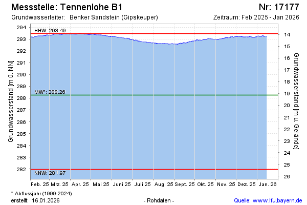
Groundwater level [m above sealevel]: 293.28
Distance to surface [m]: 14.11
Last value from 13.04.2026 09:00
Ground level [m above sealevel]: 307.39
| Date | Groundwater level [m above sealevel] |
|---|---|
| 13.04.2026 | 293.28 |
| 12.04.2026 | 293.26 |
| 11.04.2026 | 293.26 |
| 10.04.2026 | 293.25 |
| 09.04.2026 | 293.24 |
| 08.04.2026 | 293.22 |
| 07.04.2026 | 293.22 |
| 06.04.2026 | 293.22 |
© Bayerisches Landesamt für Umwelt 2026