
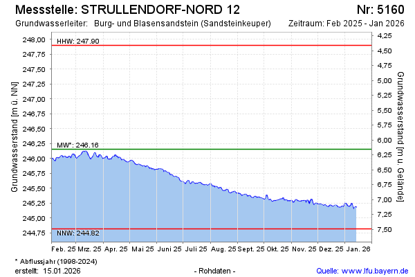
Current data STRULLENDORF-NORD 12
Groundwater level [m above sealevel]: 245,26
Distance to surface [m]: 7,05
Last value from 22.07.2026 10:00
Ground level [m above sealevel]: 252.31
| Date | Groundwater level [m above sealevel] |
|---|---|
| 22.07.2026 | 245.27 |
| 21.07.2026 | 245.26 |
| 20.07.2026 | 245.26 |
| 19.07.2026 | 245.28 |
| 18.07.2026 | 245.29 |
| 17.07.2026 | 245.29 |
| 16.07.2026 | 245.28 |
| 15.07.2026 | 245.29 |