
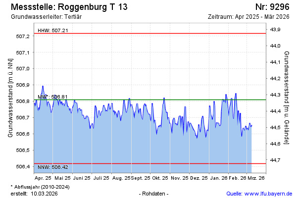
Current data Roggenburg T 13
Groundwater level [m above sealevel]: 506.55
Distance to surface [m]: 44.59
Last value from 13.07.2026 11:00
Ground level [m above sealevel]: 551.14
| Date | Groundwater level [m above sealevel] |
|---|---|
| 12.07.2026 | 506.54 |
| 11.07.2026 | 506.56 |
| 10.07.2026 | 506.59 |
| 09.07.2026 | 506.59 |
| 08.07.2026 | 506.59 |
| 07.07.2026 | 506.59 |
| 06.07.2026 | 506.59 |
| 05.07.2026 | 506.56 |