
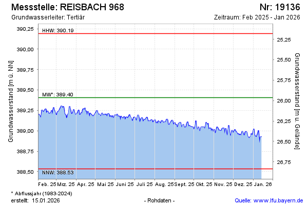
Current data REISBACH 968
Groundwater level [m above sealevel]: 388,81
Distance to surface [m]: 26,56
Last value from 15.07.2026 10:00
Ground level [m above sealevel]: 415.37
| Date | Groundwater level [m above sealevel] |
|---|---|
| 15.07.2026 | 388.82 |
| 14.07.2026 | 388.83 |
| 13.07.2026 | 388.83 |
| 12.07.2026 | 388.81 |
| 11.07.2026 | 388.82 |
| 10.07.2026 | 388.84 |
| 09.07.2026 | 388.84 |
| 08.07.2026 | 388.84 |