
- Start >
- Groundwater >
- Waterlevel of deep layer >
- Bayern >
- RAMLESREUTH D 999 >
- Current data

Current data RAMLESREUTH D 999
Groundwater levels of the last 12 months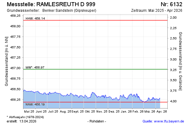
Groundwater level [m above sealevel]: 456.29
Distance to surface [m]: 3.92
Last value from 12.04.2026 04:00
Ground level [m above sealevel]: 460.21
| Date | Groundwater level [m above sealevel] |
|---|---|
| 07.11.2022 | 456.44 |
| 06.11.2022 | 456.44 |
| 05.11.2022 | 456.44 |
| 04.11.2022 | 456.46 |
| 03.11.2022 | 456.44 |
| 23.08.2022 | 456.48 |
| 22.08.2022 | 456.48 |
| 21.08.2022 | 456.49 |
© Bayerisches Landesamt für Umwelt 2026