
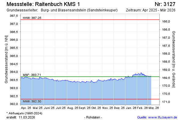
Current data Raitenbuch KMS 1
Groundwater level [m above sealevel]: 383.43
Distance to surface [m]: 169.71
Last value from 30.06.2026 13:00
Ground level [m above sealevel]: 553.14
| Date | Groundwater level [m above sealevel] |
|---|---|
| 30.06.2026 | 383.47 |
| 29.06.2026 | 383.48 |
| 28.06.2026 | 383.49 |
| 27.06.2026 | 383.50 |
| 26.06.2026 | 383.51 |
| 25.06.2026 | 383.53 |
| 24.06.2026 | 383.54 |
| 23.06.2026 | 383.54 |