
- Start >
- Groundwater >
- Waterlevel of deep layer >
- Bayern >
- Polsingen-Döckingen >
- Chart of total period

Chart of total period Polsingen-Döckingen
Groundwater levels of the total period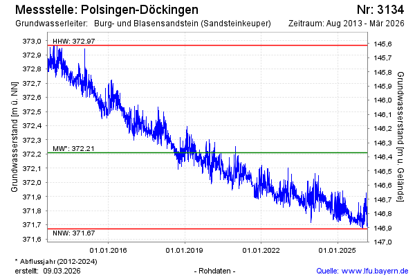
Groundwater level [m above sealevel]: 371.71
Distance to surface [m]: 146.87
Last value from 09.03.2026 13:00
Ground level [m above sealevel]: 518.58
| Date | Groundwater level [m above sealevel] |
|---|---|
| 09.03.2026 | 371.71 |
| 08.03.2026 | 371.70 |
| 07.03.2026 | 371.70 |
| 06.03.2026 | 371.71 |
| 05.03.2026 | 371.70 |
| 04.03.2026 | 371.68 |
| 03.03.2026 | 371.68 |
| 02.03.2026 | 371.70 |
© Bayerisches Landesamt für Umwelt 2026