
- Start >
- Groundwater >
- Waterlevel of deep layer >
- Bayern >
- OBERSTEINBACH (K-8) >
- Chart of total period

Chart of total period OBERSTEINBACH (K-8)
Groundwater levels of the total period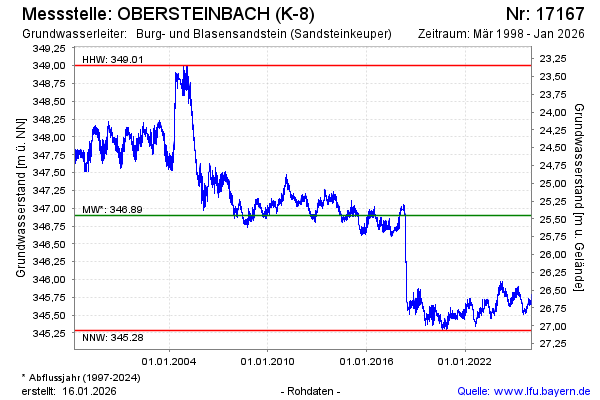
Groundwater level [m above sealevel]: 345.87
Distance to surface [m]: 26.48
Last value from 25.03.2026 10:49
Ground level [m above sealevel]: 372.35
| Date | Groundwater level [m above sealevel] |
|---|---|
| 25.03.2026 | 345.86 |
| 24.03.2026 | 345.82 |
| 23.03.2026 | 345.83 |
| 22.03.2026 | 345.84 |
| 21.03.2026 | 345.84 |
| 20.03.2026 | 345.82 |
| 19.03.2026 | 345.81 |
| 18.03.2026 | 345.81 |
© Bayerisches Landesamt für Umwelt 2026