
- Start >
- Groundwater >
- Waterlevel of deep layer >
- Bayern >
- Mallersdorf T4 >
- Current data

Current data Mallersdorf T4
Groundwater levels of the last 12 months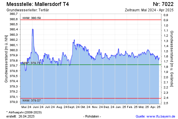
note
GW Messstelle im Grundnetz
Groundwater level [m above sealevel]: 379.75
Distance to surface [m]: 1.73
Last value from 04.05.2024 08:00
Ground level [m above sealevel]: 381.48
| Date | Groundwater level [m above sealevel] |
|---|---|
| 04.05.2024 | 379.77 |
| 03.05.2024 | 379.76 |
| 02.05.2024 | 379.72 |
| 01.05.2024 | 379.73 |
| 30.04.2024 | 379.75 |
| 29.04.2024 | 379.78 |
| 28.04.2024 | 379.80 |
| 27.04.2024 | 379.84 |
© Bayerisches Landesamt für Umwelt 2024