
- Start >
- Groundwater >
- Waterlevel of deep layer >
- Bayern >
- KLEINSCHWARZENLOHE K-7 >
- Chart of total period

Chart of total period KLEINSCHWARZENLOHE K-7
Groundwater levels of the total period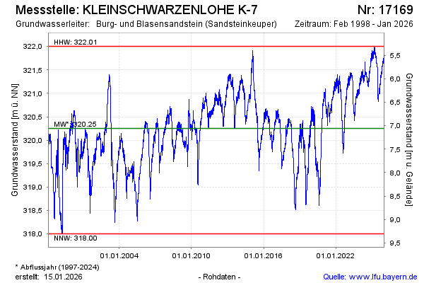
Groundwater level [m above sealevel]: 321.85
Distance to surface [m]: 5.46
Last value from 09.04.2026 10:00
Ground level [m above sealevel]: 327.31
| Date | Groundwater level [m above sealevel] |
|---|---|
| 09.04.2026 | 321.85 |
| 08.04.2026 | 321.82 |
| 07.04.2026 | 321.84 |
| 06.04.2026 | 321.82 |
| 05.04.2026 | 321.86 |
| 04.04.2026 | 321.83 |
| 03.04.2026 | 321.86 |
| 02.04.2026 | 321.84 |
© Bayerisches Landesamt für Umwelt 2026