
- Start >
- Groundwater >
- Waterlevel of deep layer >
- Bayern >
- Kaisheim W3 >
- Chart of total period

Chart of total period Kaisheim W3
Groundwater levels of the total period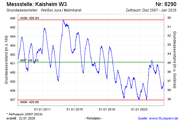
Groundwater level [m above sealevel]: 430.39
Distance to surface [m]: 35.69
Last value from 23.05.2026 12:00
Ground level [m above sealevel]: 466.08
| Date | Groundwater level [m above sealevel] |
|---|---|
| 23.05.2026 | 430.40 |
| 22.05.2026 | 430.39 |
| 21.05.2026 | 430.40 |
| 20.05.2026 | 430.44 |
| 19.05.2026 | 430.47 |
| 18.05.2026 | 430.51 |
| 17.05.2026 | 430.52 |
| 16.05.2026 | 430.57 |
© Bayerisches Landesamt für Umwelt 2026