
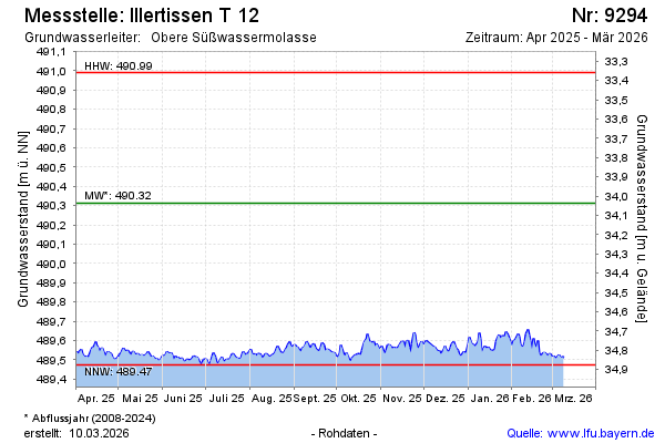
Current data Illertissen T 12
Groundwater level [m above sealevel]: 489,30
Distance to surface [m]: 35,05
Last value from 23.07.2026 10:00
Ground level [m above sealevel]: 524.35
| Date | Groundwater level [m above sealevel] |
|---|---|
| 23.07.2026 | 489.31 |
| 22.07.2026 | 489.31 |
| 21.07.2026 | 489.31 |
| 20.07.2026 | 489.32 |
| 19.07.2026 | 489.34 |
| 18.07.2026 | 489.35 |
| 17.07.2026 | 489.35 |
| 16.07.2026 | 489.34 |