
- Start >
- Groundwater >
- Waterlevel of deep layer >
- Bayern >
- IHRLERSTEIN TIEF K1 >
- Chart of total period

Chart of total period IHRLERSTEIN TIEF K1
Groundwater levels of the total period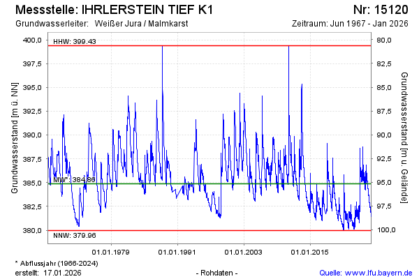
Groundwater level [m above sealevel]: 385.49
Distance to surface [m]: 94.54
Last value from 05.05.2024 10:00
Ground level [m above sealevel]: 480.03
| Date | Groundwater level [m above sealevel] |
|---|---|
| 04.05.2024 | 385.54 |
| 03.05.2024 | 385.63 |
| 02.05.2024 | 385.79 |
| 01.05.2024 | 385.81 |
| 30.04.2024 | 385.83 |
| 29.04.2024 | 385.88 |
| 28.04.2024 | 386.01 |
| 27.04.2024 | 386.12 |
© Bayerisches Landesamt für Umwelt 2024